Kanton Moncoutant
| Kanton Moncoutant | |
|---|---|
| Geografie | |
| Hlavní město | Moncoutant |
| Souřadnice | 46°42′7″ s. š., 0°32′11″ z. d. |
| Rozloha | 230,61 km² |
| Obyvatelstvo | |
| Počet obyvatel | 10 862 (2009) |
| Hustota zalidnění | 47,1 obyv./km² |
| Správa regionu | |
| Stát |
|
| Region | Poitou-Charentes |
| Departement | Deux-Sèvres |
| Arrondissement | Parthenay |
| Druh celku | Kanton |
| Podřízené celky | Obce (počet: 12) |
| Zánik | 21. března 2015 |
| Některá data mohou pocházet z datové položky. | |
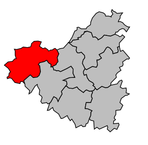
Kanton Moncoutant (fr. Canton de Moncoutant) je francouzský kanton v departementu Deux-Sèvres v regionu Poitou-Charentes. Skládá se z 12 obcí.
Obce kantonu
- L'Absie
- Le Breuil-Bernard
- Chanteloup
- La Chapelle-Saint-Étienne
- La Chapelle-Saint-Laurent
- Clessé
- Largeasse
- Moncoutant
- Moutiers-sous-Chantemerle
- Pugny
- Saint-Paul-en-Gâtine
- Trayes
