Arrondissement Romorantin-Lanthenay
| Arrondissement Romorantin-Lanthenay | |
|---|---|
| Geografie | |
| Hlavní město | Romorantin-Lanthenay |
| Souřadnice | 47°21′ s. š., 1°44′ v. d. |
| Rozloha | 2 385,15 km² |
| Geodata (OSM) | OSM, WMF |
| Obyvatelstvo | |
| Počet obyvatel | 89 052 (2009) |
| Hustota zalidnění | 37,3 obyv./km² |
| Správa regionu | |
| Stát |
|
| Region | Centre-Val de Loire |
| Departement | Loir-et-Cher |
| Druh celku | Arrondissement |
| Podřízené celky |
Kantony: 8
Obce: 63 |
| multimediální obsah na Commons | |
| Některá data mohou pocházet z datové položky. | |
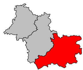
Arrondissement Romorantin-Lanthenay (fr. Arrondissement de Romorantin-Lanthenay) je správní územní jednotka ležící v departementu Loir-et-Cher a regionu Centre-Val de Loire ve Francii. Člení se dále na osm kantonů a 63 obce.
Kantony
- Lamotte-Beuvron
- Mennetou-sur-Cher
- Neung-sur-Beuvron
- Romorantin-Lanthenay-Nord
- Romorantin-Lanthenay-Sud
- Saint-Aignan
- Salbris
- Selles-sur-Cher
