Arrondissement Rennes
| Arrondissement Rennes | |
|---|---|
| Geografie | |
| Hlavní město | Rennes |
| Souřadnice | 48°10′ s. š., 1°40′ z. d. |
| Rozloha | 2 330 km² |
| Časové pásmo | UTC+01:00 (standardní čas) UTC+02:00 (letní čas) |
| Geodata (OSM) | OSM, WMF |
| Obyvatelstvo | |
| Počet obyvatel | 635 583 (2008) |
| Hustota zalidnění | 272,8 obyv./km² |
| Správa regionu | |
| Stát |
|
| Region | Bretaň |
| Departement | Ille-et-Vilaine |
| Druh celku | Arrondissement |
| Podřízené celky |
Kantony: 25
Obce: 130 |
| Některá data mohou pocházet z datové položky. | |
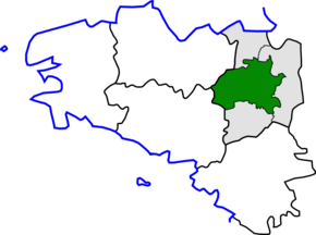
Arrondissement Rennes je správní územní jednotka ležící v departmentu Ille-et-Vilaine v regionu Bretaň ve Francii. Člení se dále na 25 kantonů a 130 obcí.
